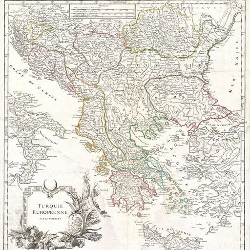
About Gilles Robert de Vaugondy
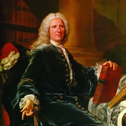
Lived 1688 – 1766 (aged 77–78). Gilles Robert de Vaugondy was a French cartographer and geographer.
Gilles Robert de Vaugondy (1688–1766), also known as Le Sieur or Monsieur Robert, and his son, Didier Robert de Vaugondy (c.1723–1786), were leading cartographers in France during the 18th century.
Life 1784 map on a Mercator projection by Robert de Vaugondy: Whites/Blancs (green), Browns/Bruns (red), Yellows/Jaunâtres (yellow), Olives/Olivâtres/ (light green). In 1757, Gilles and Didier Robert De Vaugondy published The Atlas Universel, one of the most important atlases of the 18th century. To produce the atlas, the Vaugondys integrated older sources with more modern surveyed maps. They verified and corrected the latitude and longitude of many regional maps in the atlas with astronomical observations. The older material was revised with the addition of many new place names. In 1760, Didier Robert de Vaugondy was appointed geographer to Louis XV.
Gilles and Didier Robert De Vaugondy produced their maps and terrestrial globes working together as father and son. Globes of a variety of sizes were made by gluing copperplate-printed gores on a plaster-finished papier-mache core, a complicated and expensive manufacturing process, employing several specialists. In some cases it is uncertain whether Gilles or Didier made a given map. Gilles often signed maps as "M.Robert", while Didier commonly signed his maps as "Robert de Vaugondy", or added "fils" or "filio" after his name.
The Robert de Vaugondys were descended from the Nicolas Sanson family through Sanson's grandson, Pierre Moulard-Sanson. From him, they inherited much of Sanson's cartographic material, which they combined with maps and plates acquired after Hubert Jaillot's death in 1712 to form the basis the Atlas Universel. Sources from the Dépôt de la Marine, the official French repository for maritime-related information, were used for their maps of Canada and South America.
Like Ortelius and Mercator, the Vaugondy's credited their sources, which has greatly benefited the study of the history of cartography during that period.
Don’t just read it —
keep it.
Full-length biographies made to live with: read them, listen on the way to work, watch them tonight.
- E-book
- Audio
- Video
Instant download · yours to keep · every purchase keeps this site free
Important facts
People in Gilles Robert de Vaugondy's life
Named in this biography and alive at the same time

Related people
Same field, nearest in time



Contemporaries
People whose lives overlapped Gilles Robert de Vaugondy's


Frequently asked questions
Who was Gilles Robert de Vaugondy?
French geographer (1688-1766)
When was Gilles Robert de Vaugondy born?
Gilles Robert de Vaugondy was born in 1688 in Paris.
When did Gilles Robert de Vaugondy die?
Gilles Robert de Vaugondy died in 1766 in Paris.
What was Gilles Robert de Vaugondy's occupation?
Gilles Robert de Vaugondy was a cartographer and geographer.
What nationality was Gilles Robert de Vaugondy?
Gilles Robert de Vaugondy was French.
Sources & further reading
· Wikipedia: Gilles Robert de Vaugondy
Cite this page
APA: Biography.guide. (2026). Gilles Robert de Vaugondy. https://biography.guide/gilles-robert-de-vaugondy/
MLA: "Gilles Robert de Vaugondy." Biography.guide, https://biography.guide/gilles-robert-de-vaugondy/.
Chicago: "Gilles Robert de Vaugondy." Biography.guide. https://biography.guide/gilles-robert-de-vaugondy/.
Data last updated: 2026-09-23 · Spot an error? Report a correction.
Portrait: Wikimedia Commons · author & licence
Page generated 2026-09-27 05:05 UTC