
About Johannes Mejer
Lived 1606 – 1674 (aged 67–68). Johannes Mejer was a German mathematician and cartographer.
Johannes Mejer (born 1606 in Husum; died 1674) was a mathematician and cartographer.
Life Map of Nordfriesland around 1240 (before the flood of 1362) by J. Mejer.
Mejer was the son of a pastor from Husum with the same name. His mother, Elisabeth Jüngling, was the daughter of the organist Johannes Jüngling (1522–1627) from Bovenau. His exact date of birth is unknown; he was baptized on October 12, 1606.
The early death of his father in 1617 left the family in poverty. With the support of his uncle , he studied mathematics and astronomy in Copenhagen. At the university, he learned the fundamentals of cartography practiced there since Tycho Brahe. After returning to Husum around 1629, Mejer worked as a teacher, occasional poet, almanac maker, and cartographer. In 1635 and 1636, Mejer worked for Duke Friedrich III, Duke of Holstein-Gottorp. With the duke's support, he undertook a study trip to Holland in 1637. Under the commission of the duke, Mejer completed an atlas of Apenrade Amthouse in 1641. He received support from Joachim Danckwerth, the Apenrade Amthouse administrator. Successful in mapping the Schlei with its herring weirs, two copies of the Schlei Atlas containing 40 and 43 maps are preserved. One is located in the , while the other is in the Royal Library in Copenhagen. In 1639, Mejer drew what is likely the oldest usable map of Heligoland Island, Nova Tabula Helgolandiae.
In 1647, Christian IV of Denmark appointed Mejer as the royal mathematician. The Danish king commissioned Mejer to survey the west coast of Schleswig-Holstein first. A pamphlet titled Nordfriesland – früher und heute states: "These two maps of Nordfriesland from the years 1240 and 1634 are by the Husum cartographer Johannes Meyer. He created these maps in 1649. For the production of these drawings and their outlines, he must have had accurate materials."
In 1652, published his with 40 maps and city plans by Mejer. Danckwerth's land description was modeled after Willem Janszoon Blaeu's Novus Atlas, published in 1645. Most of Mejer's maps were artistically embellished by the brothers Mathias and Nicolaus Petersen and engraved on copper plates by Andreas and Christian Lorenzen, known as "Rodtgießer." Mejer's maps of the duchies of Schleswig and Holstein served as a basis for renowned cartographers and publishers (Janssonius, Visscher, Schenk, Homann, Seutter, Lotter, and others) for decades. However, Mejer could not financially benefit from this because Danckwerth's widow sold the copper plates to the Dutch publisher Joan Blaeu in 1657 and withheld Mejer's share of the profits.
Mejer felt lifelong commitment to the great Danish astronomer Tycho Brahe. He adopted Brahe's world model and had a representation of it engraved in copper in 1651.
He died at the beginning of June 1674 and was buried on June 10.
His estate is preserved in the Royal Library in Copenhagen.
Publications Kurt Domeier: Die Landkarten von Johannes Mejer, Husum, aus der neuen Landesbeschreibung der zwei Herzogtümer Schleswig und Holstein von Caspar Danckwerth 1652. Heinevetter, Hamburg-Bergedorf 1963. Henning Ratjen: Johann Mejer und Caspar Danckwerth In: Volksbuch auf das Jahr 1846 für die Herzogthümer Schleswig-Holstein und Lauenburg Publisher of the expedition of the Altona Mercury, Altona 1846. Dagmar Unverhau: Der Schleiatlas von Johannes Mejer (1641) In: Kartographiehistorisches Colloquium Lüneburg 84, Berlin 1985, S. 103–124. Dagmar Unverhau: Der Schleiatlas von Joh. Mejer (1641) – Kartengeschichtliches Kleinod des Landesarchivs. In: Die Heimat. Zeitschrift für Natur- und Landeskunde von Schleswig-Holstein und Hamburg. Bd. 93 (1986), Nr. 2, Februar, S. 45–64 (scans). Mejer, Johannes. In: Olaf Klose, Eva Rudolph (Hrsg.): Schleswig-Holsteinisches Biographisches Lexikon. Bd. 4. Karl Wachholtz Verlag, Neumünster 1976, S. 147–150. Oswald Dreyer-Eimbcke: 400 Jahre Johannes Mejer – Der große Kartograph aus Husum (1606–1674) Komregis-Verlag, Oldenburg 2006.
Links
P. Lauridsen: Kartografen Johannes Mejer. In: Historisk Tidsskrift Bind 6. række, 1 (1887–1888) 1 (Danish, archived on archive.org).
Don’t just read it —
keep it.
Full-length biographies made to live with: read them, listen on the way to work, watch them tonight.
- E-book
- Audio
- Video
Instant download · yours to keep · every purchase keeps this site free
Important facts
People in Johannes Mejer's life
Named in this biography and alive at the same time


Related people
Same field, nearest in time
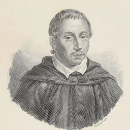
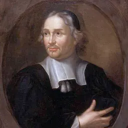

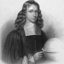

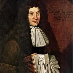
Contemporaries
People whose lives overlapped Johannes Mejer's



Frequently asked questions
Who was Johannes Mejer?
German mathematician and cartographer (1606–1674)
When was Johannes Mejer born?
Johannes Mejer was born in 1606 in Husum.
When did Johannes Mejer die?
Johannes Mejer died in 1674 in Husum.
What was Johannes Mejer's occupation?
Johannes Mejer was a mathematician and cartographer.
What nationality was Johannes Mejer?
Johannes Mejer was German.
Sources & further reading
Cite this page
APA: Biography.guide. (2026). Johannes Mejer. https://biography.guide/johannes-mejer/
MLA: "Johannes Mejer." Biography.guide, https://biography.guide/johannes-mejer/.
Chicago: "Johannes Mejer." Biography.guide. https://biography.guide/johannes-mejer/.
Data last updated: 2026-09-20 · Spot an error? Report a correction.
Page generated 2026-09-27 05:32 UTC