
About Joan Blaeu
Lived 1596 – 1673 (aged 77). Joan Blaeu was a Dutch cartographer, publisher, instrument maker, book printer, photographer and printer.
Joan Blaeu (; 23 September 1596 – 21 December 1673), also called Johannes Blaeu, was a Dutch cartographer and the official cartographer of the Dutch East India Company. Blaeu is most notable for his map published in 1648, which was the first map to incorporate the heliocentric theory into a map of the world and was the first map that incorporated the discoveries of Abel Tasman. Blaeu renamed what is now New Zealand as Nieuw Zeeland after the Dutch province of Zeeland; the anglicized version of the name is still in use today.
Early life Joan Blaeu was born in 1596, the son of the cartographer Willem Blaeu and brother of Cornelis Blaeu. In 1620, Blaeu completed a doctor of law.
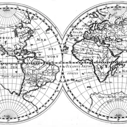
Blaeu's world map, Nova et Accuratissima Terrarum Orbis Tabula was published in 1648. This map was the first that depicted the Solar System according to the heliocentric theories of Nicolaus Copernicus, first printed in 1543, which show the earth revolving around the sun. This map was used as a template for the design of the pavement of the Groote Burger-Zaal of the new Amsterdam Town Hall, designed by the Dutch architect Jacob van Campen (now the Amsterdam Royal Palace), in 1655.
Blaeu's Hollandia Nova was also depicted in his Archipelagus Orientalis sive Asiaticus published in 1659 in the Kurfürsten Atlas (Atlas of the Great Elector), and was used by Melchisédech Thévenot to produce his map, Hollandia Nova—Terre Australe (1664).
He also published the 12-volume Le Grand Atlas, ou Cosmographie blaviane, en laquelle est exactement descritte la terre, la mer, et le ciel. One edition is dated 1663, in folio , which contained 593 engraved maps and plates.
Around 1649, Blaeu published a collection of Dutch city maps named Toonneel der Steeden (Views of Cities). In 1651, he was voted into the Amsterdam council. In 1654, Blaeu published the first atlas of Scotland, devised by Timothy Pont.
Blaeu was fiercely competitive with his contemporary Johannes Janssonius as to which of them could make an atlas with a higher quantity of maps. In 1662, Blaeu published the Atlas Maior, it had 11 volumes and included 600 maps. This atlas became a status symbol for those who owned it and was the most expensive book of the 17th century.
A cosmology was planned, but a fire destroyed the studio and all of Blaeu's work in December 1672.
Death Blaeu died 21 December 1673, in Amsterdam. He is buried in the Amsterdam Westerkerk. He was survived by his son, Joan II, who continued his father's work until 1712.
Don’t just read it —
keep it.
Full-length biographies made to live with: read them, listen on the way to work, watch them tonight.
- E-book
- Audio
- Video
Instant download · yours to keep · every purchase keeps this site free
Important facts
more
Joh Blaeu, Bleau, Ioan. Blaeu uitg., Jan BlaeuPeople in Joan Blaeu's life
Named in this biography and alive at the same time



Related people
Same field, nearest in time


Contemporaries
People whose lives overlapped Joan Blaeu's



Frequently asked questions
Who was Joan Blaeu?
Dutch cartographer (1596-1673)
When was Joan Blaeu born?
Joan Blaeu was born on 23 September 1596 in Alkmaar.
When did Joan Blaeu die?
Joan Blaeu died on 28 December 1673 in Amsterdam.
What was Joan Blaeu's occupation?
Joan Blaeu was a cartographer, publisher, instrument maker, book printer, photographer and printer.
What nationality was Joan Blaeu?
Joan Blaeu was Dutch.
Sources & further reading
Cite this page
APA: Biography.guide. (2026). Joan Blaeu. https://biography.guide/joan-blaeu/
MLA: "Joan Blaeu." Biography.guide, https://biography.guide/joan-blaeu/.
Chicago: "Joan Blaeu." Biography.guide. https://biography.guide/joan-blaeu/.
Data last updated: 2026-09-20 · Spot an error? Report a correction.
Page generated 2026-09-27 05:19 UTC