
William F. Raynolds
U.S. Army surveyor and topographer
About William F. Raynolds
Lived 1820 – 1894 (aged 74). William F. Raynolds was an American explorer, military officer, mountaineer, discoverer and surveying engineer.
William Franklin Raynolds (March 17, 1820 – October 18, 1894) was an American explorer, engineer and U.S. army officer who served in the Mexican–American War and American Civil War. He is best known for leading the 1859–60 Raynolds Expedition while serving as a member of the U.S. Army Corps of Topographical Engineers.
During the 1850s and again after his participation in the Civil War, Raynolds was the head engineer on numerous lighthouse construction projects. He oversaw riverway and harbor dredging projects intended to improve accessibility and navigation for shipping. As a cartographer, Raynolds surveyed and mapped the islands and shorelines on the Great Lakes and other regions. At least six lighthouses whose construction he oversaw are still standing. Some are still in use and of these, several are listed on the National Register of Historic Places.
In 1848, during the American occupation of Mexico after the Mexican–American War, Raynolds and other U.S. Army personnel were the first confirmed to have reached the summit of Pico de Orizaba, the tallest mountain in Mexico, and inadvertently set what may have been a 50-year American alpine altitude record. In 1859, Raynolds was placed in charge of the first government-sponsored expedition to venture into the upper Yellowstone region that was later to become Yellowstone National Park. Heavy winter snowpack in the Absaroka Range of Wyoming prevented the expedition from reaching the Yellowstone Plateau, forcing them to divert to the south and cross Union Pass at the northern end of the Wind River Range. After negotiating the pass the expedition entered Jackson Hole and surveyed the Teton Range, now within Grand Teton National Park.
During the Civil War, Raynolds participated in the Battle of Cross Keys during the Valley Campaign of 1862 and a year later was in charge of fortifications in the defense of the military arsenal at Harpers Ferry, West Virginia. On March 13, 1865, Raynolds was brevetted brigadier general for meritorious service during the Civil War. After the war, Lt. Col Raynolds was assigned to a myriad of positions across the Nation to include establishing the St. Louis Engineer Office of the U.S. Army Corps of Engineers from 1870 to 1872. Raynolds retired from the army on March 17, 1884, with the permanent rank of colonel.
Early life
William Franklin Raynolds was born on March 17, 1820, in Canton, Ohio, the fourth of six children to William Raynolds and Elizabeth Seabury (née Fisk). William F. Raynolds's grandfather, also named William Raynolds, was a veteran of the War of 1812, serving as a company captain from April 12, 1812, until April 13, 1813. During the War of 1812, the grandfather Raynolds rose to the rank of major while serving under Lewis Cass.
William F. Raynolds entered the United States Military Academy at West Point, New York, on July 1, 1839, after being appointed from Ohio. He graduated fifth out of 39 classmates in his class of 1843. The Topographical Engineers performed surveys and developed maps for army use until their merger with the Corps of Engineers in 1863. Raynolds's first assignments from 1843 to 1844 were as an assistant topographical engineer involved in improving navigation on the Ohio River and surveying the northeastern boundary of the U.S. between 1844 and 1847. Over a period of several months, Raynolds and other officers from both the army and navy mapped the best approach route to Pico de Orizaba. To assist them in their climb, the party planned on taking grapnels attached to long ropes and primitive crampons in the form of shoes with projecting points to help ensure they could safely climb up cliffs and across glaciers. Told by local villagers that any attempt to reach the summit would be fruitless because no one had ever done it before, (In 1838, French-Belgian botanist Henri Guillaume Galeotti may have climbed as high as the mountain crater but he made no claim to have reached the summit.) Neither the Mexicans nor the Americans were aware of Galeotti's earlier visit. Raynolds estimated the summit of Pico de Orizaba to be above sea level, which was slightly greater than previous estimates but below the modern known altitude. As no higher peaks were known in North America at that time, Raynolds believed Pico de Orizaba was the tallest mountain on the continent. After promotion to first lieutenant and then captain, in 1857 he was assigned to design and supervise the construction of lighthouses along the Jersey Shore and the Delmarva Peninsula regions. In 1859, Raynolds was working on finishing the Jupiter Inlet Light in Jupiter, Florida, when he was reassigned to lead the first U.S. Government-sponsored expedition to explore the Yellowstone region.
Raynolds Expedition
The Great Falls of the Missouri River (1860) by James D. Hutton is one of the few remaining photographs taken during the expedition. The wet-plate photographic techniques available at the time of the expedition provided only poor quality imagery.
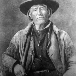
In early 1859, Raynolds was charged with leading an expedition into the Yellowstone region of Montana and Wyoming to determine, "as far as practicable, everything relating to ... the Indians of the country, its agricultural and mineralogical resources ... the navigability of its streams, its topographical features, and the facilities or obstacles which the latter present to the construction of rail or common roads ..." The expedition was carried out by a handful of technicians, including photographer and topographer James D. Hutton, artist and mapmaker Anton Schönborn, and geologist and naturalist Ferdinand V. Hayden, who led several later expeditions to the Yellowstone region. Raynolds's second-in-command was lieutenant Henry E. Maynadier. The expedition was supported by a small infantry detachment of 30 and was federally funded with $60,000. Experienced mountain man Jim Bridger was hired to guide the expedition. In late June the expedition left New Fort Pierre and headed overland to Fort Sarpy where they encountered the Crow Indians. Raynolds said the Crow were a "small band compared to their neighbors, but are famous warriors, and, according to common report, seldom fail to hold their own with any of the tribes unless greatly outnumbered." Raynolds was impressed with Chief Red Bear and, after assuring him the expedition meant only to pass through their territory and not linger, traded with the Crow for seven horses. By September 2, 1859, Raynolds's detachment had followed the Yellowstone River to the confluence with the Bighorn River in south-central Montana. "Principal Chiefs of the Arapaho Tribe" is an engraving after a photograph taken by James Hutton during the expedition. The Arapaho interpreter Warshinun is seated at right. The expedition recommenced its explorations in May 1860. Raynolds led a party north and west up the upstream portion of the Bighorn River, which is today called the Wind River, hoping to cross the mountains at Togwotee Pass in the Absaroka Range, a mountain pass known to expedition guide Jim Bridger. Meanwhile, Maynadier led his party back north to the Bighorn River to explore it and its associated tributary streams more thoroughly. The plan was for the two parties to reunite on June 30, 1860, at Three Forks, Montana, so they could make observations of a total solar eclipse forecast for July 18, 1860. The expedition covered over and explored an area of nearly . Raynolds's immediate participation in the Civil War, followed by a severe illness, delayed him from presenting his report on the expedition until 1868.
As the end of war approached and hostilities with the Sioux Indians loomed, Raynolds's knowledge of and experiences in the Great Lakes region became more important to the army than his command of the fortifications of Harpers Ferry. As a result, he returned to the Great Lakes as superintending engineer of surveys and lighthouses in April 1864, and saw no further combat for the rest of his career. Raynolds was promoted to permanent rank of lieutenant colonel in the Corps of Engineers on March 7, 1867.
In 1870, work on the harbors received a boost when the Office of Western River Improvements relocated from Cincinnati, Ohio, to St. Louis with the reassignment of Lt. Col. Raynolds as officer in charge. Since the 1830s, the work of the Office of Western River Improvements had been divided between the Ohio River on one hand and Mississippi, Arkansas, Red, and Missouri rivers on the other. In practice, engineer officers in the Corps of Topographical Engineers maintained temporary offices near each project to oversee work, including one in St. Louis or Alton. After the Civil War and the reunification of the Topographical Engineers and Corps of Engineers, there were separate offices overseeing work on the Ohio River and Western Rivers, each reporting separately to the Chief of Engineers. Most of this work remained snag removal, for which the Corps had built numerous snag-removal vessels. It was only logical to relocate the office closer to the projects being managed by moving the Office of Ohio River Improvements to Cincinnati and Western River Improvements to St. Louis. This was, in essence, the first step taken from a project-based Corps office in St. Louis to what became a district office overseeing regional projects. By 1872, Raynolds was reporting from the Engineer Office in St. Louis with responsibility from the Illinois to the Ohio River rather than from the Office of Western River Improvements, which had ceased to exist.
From May5 to October 7, 1877, Raynolds led a procession of American engineers to an engineering conference in Europe. According to West Point classmate Joseph J. Reynolds, who saw him at the West Point graduates' reunion in 1893, Raynolds maintained a vigorous and healthy appearance long after his retirement, his brown hair, "then but slightly sprinkled with gray".
Legacy
Raynolds's 1848 expedition to the summit of Pico de Orizaba in Mexico predated what is known as the Golden age of alpinism (1854–65), when many major mountain peaks in the Alps were first climbed. The effort to summit the mountain was one of the earliest deliberate attempts to climb a major mountain peak, and involved logistics, planning and use of rudimentary climbing equipment, "making it one of the more serious mountaineering expeditions undertaken to that point in history". Several lighthouses whose construction was designed or supervised by Raynolds are still in use and several are listed on the National Register of Historic Places.
At least two geographical locations are named for William Raynolds. The mountain gap where his expedition crossed the Continental Divide between southwest Montana and northeast Idaho is named Raynolds Pass and Raynolds Peak is an isolated peak in the Teton Range that was named after him in 1938. The fossil remains of the extinct gastropod Viviparus raynoldsanus was named by Ferdinand V. Hayden in honor of Raynolds after the specimen was collected in the Powder River Basin during the expedition.
Lt. Col. William F. Rayholds is credited with being the first Commander of the St. Louis Engineer Office (now District) with the U.S. Army Corps of Engineers (USACE) as it transferred from the Office of Western River Improvements out of Cincinnati.
Don’t just read it —
keep it.
Full-length biographies made to live with: read them, listen on the way to work, watch them tonight.
- E-book
- Audio
- Video
Instant download · yours to keep · every purchase keeps this site free
Important facts
People in William F. Raynolds's life
Named in this biography and alive at the same time


Related people
Same field, nearest in time

Contemporaries
People whose lives overlapped William F. Raynolds's



Frequently asked questions
Who was William F. Raynolds?
U.S. Army surveyor and topographer (1820-1894)
When was William F. Raynolds born?
William F. Raynolds was born on 17 March 1820 in Canton.
When did William F. Raynolds die?
William F. Raynolds died on 18 October 1894 in Detroit.
What was William F. Raynolds's occupation?
William F. Raynolds was an explorer, military officer, mountaineer, discoverer and surveying engineer.
What nationality was William F. Raynolds?
William F. Raynolds was American.
Sources & further reading
· Wikipedia: William F. Raynolds
· DBpedia: William F. Raynolds
Cite this page
APA: Biography.guide. (2026). William F. Raynolds. https://biography.guide/william-f-raynolds/
MLA: "William F. Raynolds." Biography.guide, https://biography.guide/william-f-raynolds/.
Chicago: "William F. Raynolds." Biography.guide. https://biography.guide/william-f-raynolds/.
Data last updated: 2026-09-25 · Spot an error? Report a correction.
Page generated 2026-09-27 05:11 UTC