
Nicholas Lane
17th century English surveyor and cartographer
About Nicholas Lane
Lived 1585 – 1644 (aged 58–59). Nicholas Lane was an English cartographer, cartography and surveying.
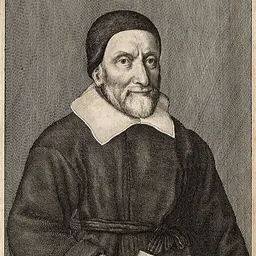
Early career He was professionally active as a surveyor by 1613 when he mapped lands at Painshill which were the subject of a continuing dispute between Robert Bickerstaffe and James Starr, and somewhat later he surveyed the manor of Slyfield in Great Bookham for the purpose of arbitration proceedings arising from its sale by Henry Bretton to George Shiers, apothecary to James I, in 1614. Lane’s deposition in a subsequent Chancery suit reveals that he used the chain and plane table methods in his survey and that his measurements of the Slyfield lands were substantially consistent with those of William Oughtred who had earlier surveyed the property for Shiers and afterwards cooperated with Lane to “perfect” their work. A recent assessment of another of Lane’s maps confirms “overall accuracy of over 99%”.
In the 1620s he worked for John Goode and his son, Sebastian Goode, of Malden. In 1621 he mapped land at Chessington forming part of the manor of Malden, held by John Goode from the Crown but claimed by Merton College, Oxford. Six years later, following compromise of Merton's ejectment action against the Goodes, Lane mapped the whole manor for the son. The area was the subject of a long-running dispute concerning the boundary between the College's land and the Royal estate of Nonsuch Great Park (the part that subsequently became known as Worcester Park). Lane's map of 1627 documents the outcome of litigation in the matter, which was reconfirmed by Charles I in 1633.
Later career The social status of Lane's clients increased and in the later 1630s he was employed by the Crown in connection with the creation of both Richmond Park and Longford River. His map of the park shows the several courses he surveyed for the perimeter wall and identifies the option ultimately chosen in January 1638. In the same year he was commissioned to plan the scheme whereby water from the River Colne at Longford would be diverted to Hampton Court Palace. The channel he proposed, 19,000 metres in length with an overall fall of 8 metres, was cut in little more than nine months by Edward Manning, the same contractor who had built the Richmond Park wall. From £4,000 spent on the Longford project, Lane was allowed £5 for his work. The new river fed the fountains at Hampton Court and, later, the water features in Bushy Park. The layout of Bushy Park has also been attributed to Lane.
Also in the 1630s Lane had been active for the Crown in the Fens, and his sketches of large tracts of land between Peterborough and Wisbech survive. “Mr Lane's propositions for various works to be constructed in the fen district, co. Lincoln” were costed by Simon Hill, Director of Works in the Fens, in 1636, perhaps indicating that Nicholas Lane had previously devised water management schemes that recommended him for the Longford River assignment. By this time he was supported in his work by his son Nicholas, and in 1637 he took another of his sons, Thomas, as his apprentice. Essex, and Hertfordshire. The signatures of both Nicholas senior and junior appear on a map of Putney on which they evidently collaborated in 1636/7.
A 1640 map of lands in Wonersh, commissioned by Viscount Montagu, whose Sussex estates Lane had mapped some years earlier, may be Lane's last known work. A 1642 map of a small part of Horton in Buckinghamshire has been attributed to him but bears what looks more like the signature of his son Nicholas.
He died in 1644 and was buried at Kingston where he had lived in Wood Street and had been a churchwarden.
Legacy Lane's surviving work provides a valuable resource for historians. For example, Lane's map of Putney, combined with the 1665 hearth tax list, has provided a key source for reconstructing a detailed view of life in the London suburb in the later seventeenth century. In 1787 it furnished information relevant to resolving the disputed boundary between Putney and Wandsworth parishes.
Maps
Lane's maps of the following are known to survive:
Lands at Painshill, Cobham, Surrey, November 1613 Lands belonging to Faversham Grammar School and Ewell House, Kent, April 1615 (held by The Faversham Society) Oxdownes in Cobham parish, Surrey, 1618 Malden Common and Chessington Park, Surrey, 1621 Enclosures in the Royal Manor of Ligham and Balham, Surrey, 1622 Manor of Beckenham, Kent, 1623 Malden parish, Surrey, 1627 Manor of West Wickham, Kent, 1632 Part of the Manor of Cryalls, Brenchley, Kent, August 1632 Manor of Dagenham and Cockrels, Delland and Mauland, Romford, Essex, April 1633 Greatworth, Northamptonshire, December 1634 Manor of Skreens of Teyhall in Roxwell, Shellow Bowells and Willingale, Essex, July 1635 Manor of Cocking, Midhurst, West Sussex, 1635 Great Common Fen and its surroundings, showing drains and dikes, near Wisbech, Cambridgeshire, 1637. Wigging Moore, Sir Oliver Cromwell's at Wigging, Abbotts Pingle and common belonging to Ramsey, Huntingdonshire, 1637 Richmond Common, Petersham Common and Mortlake Common, with parts of Roehampton, Kingston, Wimbledon and Combe, showing the extent of the “New Park” (Richmond Park), Surrey, 1637 Copyhold lands in Wonersh, Surrey, 1640
Don’t just read it —
keep it.
Full-length biographies made to live with: read them, listen on the way to work, watch them tonight.
- E-book
- Audio
- Video
Instant download · yours to keep · every purchase keeps this site free
Important facts
People in Nicholas Lane's life
Named in this biography and alive at the same time

Related people
Same field, nearest in time


Contemporaries
People whose lives overlapped Nicholas Lane's


Frequently asked questions
Who was Nicholas Lane?
17th century English surveyor and cartographer
When was Nicholas Lane born?
Nicholas Lane was born in 1585 in Cobham, Surrey.
When did Nicholas Lane die?
Nicholas Lane died in 1644.
What was Nicholas Lane's occupation?
Nicholas Lane was a cartographer, cartography and surveying.
What nationality was Nicholas Lane?
Nicholas Lane was English.
Sources & further reading
Cite this page
APA: Biography.guide. (2026). Nicholas Lane. https://biography.guide/nicholas-lane/
MLA: "Nicholas Lane." Biography.guide, https://biography.guide/nicholas-lane/.
Chicago: "Nicholas Lane." Biography.guide. https://biography.guide/nicholas-lane/.
Data last updated: 2026-09-22 · Spot an error? Report a correction.
Page generated 2026-09-27 05:16 UTC