
About Megan Lang
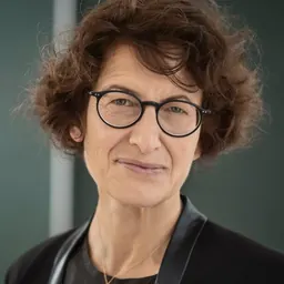
Megan Lang was an American researcher and geospatial analyst.
Megan Lang is an American geospatial analyst and wetland scientist currently working as Chief Scientist for the U.S. Fish and Wildlife Service National Wetlands Inventory Program, as well as Project Lead for the Wetlands Status and Trends study. She is known for her work in LiDAR (Light Detection and Ranging) and SAR (Synthetic Aperture Radar) being used to map and study isolated and obscured wetland systems.
Education Lang began her career as an undergraduate at the College of Charleston in South Carolina in 1996. During that time she researched ecological succession in abandoned rice fields with an emphasis on how human activities impact the natural recovery of affected wetlands.
She completed her doctoral education at the University of Maryland in Remote Sensing and Geospatial Analysis. Her PhD research focused on the effects that climate change has on ecological dynamics within wetlands, with an emphasis on spatial tools being primarily used to track how wetlands change over time.
Career Before having joined the USFWS, Lang was a research associate professor at the Department of Geographical Sciences at the University of Maryland. Lang also worked as the Chief Scientist for the National Wetlands Inventory (NWI). Lang's work helps connect the scientific remote-sensing field of wetland science to federal environmental policy like the North American Wetlands Conservation Act.
Geographically Isolated Wetlands A keystone in her research is specific wetlands that do not have any hydrologic connection to a body of water, or "Geographically Isolated Wetlands" (GIWs). Lang's research touches on this heavily as it provides substantial empirical evidence that even seemingly completely isolated wetland systems have a large impact to downstream waters by way of a groundwater connection, sometimes referred to in legislature as a "significant nexus".
Wetlands trends Under Lang, the USFWS published the Status and Trends of Wetlands in the Conterminous United States 2009 to 2019 report. In this report it was stated that the national wetland loss rates in the United States increased by 50 percent compared to the previous decade, with the greatest losses happening in marshes and swamps, where tree cover is prevalent and makes accurate analysis more difficult.
Don’t just read it —
keep it.
Full-length biographies made to live with: read them, listen on the way to work, watch them tonight.
- E-book
- Audio
- Video
Instant download · yours to keep · every purchase keeps this site free
Important facts
Related people
Same field, nearest in time





Frequently asked questions
Who was Megan Lang?
American geospatial analyst and wetland scientist
What was Megan Lang's occupation?
Megan Lang was a researcher and geospatial analyst.
What nationality was Megan Lang?
Megan Lang was American.
Sources & further reading
Cite this page
APA: Biography.guide. (2026). Megan Lang. https://biography.guide/megan-lang/
MLA: "Megan Lang." Biography.guide, https://biography.guide/megan-lang/.
Chicago: "Megan Lang." Biography.guide. https://biography.guide/megan-lang/.
Data last updated: 2026-09-20 · Spot an error? Report a correction.
Page generated 2026-09-27 05:24 UTC