
About Georg Braun
Lived 1542 – 1622 (aged 79–80). Georg Braun was a German cartographer, geographer, deacon, theologian, writer and visual artist.
Georg Braun (also Brunus, Bruin; 1541 – 10 March 1622) was a German topo-geographer. From 1572 to 1617, he edited the Civitates orbis terrarum which contains 546 prospects, bird's-eye views and maps of cities from all around the world. As principal editor of the work, he acquired the tables, hired the artists, and wrote the texts. He died as an octogenarian in 1622, the only survivor of the original team to witness the publication of volume VI in 1617.
Career Braun was born and died in Cologne. His principal profession was a Catholic cleric. He spent thirty-seven years as canon and dean at the church, St. Maria ad Gradus, in Cologne.
His six-volume work was inspired by Sebastian Münster's Cosmographia. In form and layout it resembles the 1570 Theatrum orbis terrarum by Abraham Ortelius, as Ortelius was interested in a complementary companion for the Theatrum.
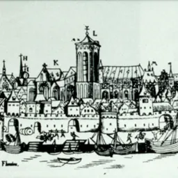
In 1572 the Civitates Orbis Terrarum (Atlas of Cities in the World) was published and is today noted as the first atlas that contained city maps. Braun recorded that London is "famed among many people for its commerce". The 546 city views in the atlas contain street plans for Venice and Frankfurt. The Civitates Orbis Terrarum must be regarded as 16th century European view of urban social, cultural, and economic life. In the 16th century the number of people who traveled increased. Pilgrims, tradesmen, students, and adventurers were joined by tourists. The interest in the 1572 Civitates Orbis Terrarum was significant and the atlas sold well. The entire atlas was crafted in six volumes and published between 1572 and 1618.
Cartography
The Braun publication set new standards in cartography for over 100 years. Frans Hogenberg (1535–1590, from Mechelen) created the tables for volumes I through IV, and Simon van den Neuwel created those for volumes V and VI. Other contributors were Joris Hoefnagel, Jacob Hoefnagel, cartographer Daniel Freese, and Heinrich Rantzau. Works by Jacob van Deventer, Sebastian Münster, and Johannes Stumpf were also used. Primarily European cities are depicted in the publication. However, Cairo Casablanca and Mexico City as well as Cuzco on one sheet are also included in volume I, whereas Tunis is featured in volume II.
Don’t just read it —
keep it.
Full-length biographies made to live with: read them, listen on the way to work, watch them tonight.
- E-book
- Audio
- Video
Instant download · yours to keep · every purchase keeps this site free
Important facts
People in Georg Braun's life
Named in this biography and alive at the same time




Related people
Same field, nearest in time


Contemporaries
People whose lives overlapped Georg Braun's


Frequently asked questions
Who was Georg Braun?
German cleric, canon, dean
When was Georg Braun born?
Georg Braun was born in 1542 in Cologne.
When did Georg Braun die?
Georg Braun died on 10 March 1622 in Cologne.
What was Georg Braun's occupation?
Georg Braun was a cartographer, geographer, deacon, theologian, writer and visual artist.
What nationality was Georg Braun?
Georg Braun was German.
Sources & further reading
Cite this page
APA: Biography.guide. (2026). Georg Braun. https://biography.guide/georg-braun-cartographer/
MLA: "Georg Braun." Biography.guide, https://biography.guide/georg-braun-cartographer/.
Chicago: "Georg Braun." Biography.guide. https://biography.guide/georg-braun-cartographer/.
Data last updated: 2026-09-20 · Spot an error? Report a correction.
Page generated 2026-09-27 05:09 UTC